Showing posts with label lake. Show all posts

22 April 2018

April, The Month of all Possibilities

It used to be the month of May, but with the climate warming we are experiencing, April seem to become the new May.

It is a month when winter and summer meet, when the forests turn green and the winter is looking for refuge higher and higher on the peaks. April weather can have many surprises, from late snow to sunny and warm days like in summer. The sun gets high in the sky and the daylight is long and generous.

Last year we had a late snowfall so I could ski down to the city for a couple of days before the strong springtime sun melted it quickly. This year the weather is unusually warm and very dry and the sunshine makes it hard to resist indoors...

Here are some photos I took this month while enjoying various outdoor activities around Brasov. This is why I love Brasov. There is so much variety!

Trail running towards Postăvarul Peak

Last ski day of the season on Postăvarul Mountain

Morning mountain run. With snow-crampons on the frozen snow on Piatra Mare Mountain.

Road cycling at the foot of Piatra Craiului Mountain

Cycling by the lakes at Dumbrăvița.

Cycling: Crossing Olt river close to Brasov. I guess it looks good or rafting...

Trail running... Watch out! The brown bears are hungry, out of hibernation

Ski Mountaineering. Going up the steep Alba Valley in Bucegi Mountains 

Ski Mountaineering. Descending on Priponului Valley, Bucegi Mountains 

Admiring the fresh green on Tampa mountain near Brasov.

Hiking through the forest


25 September 2017

Cycling on flat-lands

After a break of four years when I only did a bit of utilitarian cycling, this year I started to do a bit more cycling again. Not mountain-biking as before. Since I started to do trail running more seriously,  I feel that running is much better suited for the type of mountain trails we have around Brasov. This time I have returned to road cycling after many years... On roads I am exploring other landscapes around Brasov, not than just mountains. There are many secondary roads with good surface around Brasov, just perfect for road cycling.

The highlight of the cycling season was a cycling tour in the Netherlands. It was a last minute decision. Myself and my wife had some holiday days left for the end of the summer. As she is still recovering from an ankle injury, hiking was out of the question, but cycling was OK. 
Knowing how good the cycling infrastructure is in Holland, I proposed that we could go there for cycling in a safer road environment than in Romania.

My wife quickly searched the web for a fully organised tour. As we have never been cycling in Holland before, this was the safest option to ensure a last minute successful holiday. Most organised cycling tours seem to target the older generation; have short daily distances and e-bike option. Anyway, my wife managed to find a tour operator that had road bike tours on the menu: Holland Bike Tours. As both of us are quite well trained for endurance, we went straight for the most demanding tour they have on offer: Lake Ijssel Round Rrip; 400km in four days.

The tour was very well organised. It was an individual tour. The tour operator provided us with good quality road bicycles and a GPS device pre-loaded with the tour route. They also gave us a set of lightweight tools, a pump and a spare tube. In case we had more trouble, full bike assistance was included - luckily we had no need for it. We only had a punctured tire during the whole trip.
The hotels on the route were all booked by the tour operator, including our luggage transfer from one hotel to the next one on the route.

The GPS device was very helpful ans saved us a lot of time - especially important on the long stages. Due to the many canals that criss-cross the landscape, getting from A to B might not be as simple as it seems... Just using a compass is not of much use for finding your way in Holland...

Cycling on flat-land was tougher than I thought! We live in the mountains, so most cycling routes are 50% up-hill and 50% downhill. Moreover, the mountains protect us from strong winds. Covering a similar distance on the plains felt harder, especially with head-wind. Sure enough, half of the tour we had to work hard against the wind! Even with tail-winds, you still have to pedal, unlike on mountains down-hills...

We both enjoyed the tour very much. The landscape of Holland is as different from home as it can be! It felt like being in a delta, which in fact is the case. What I find amazing is that all the landscape we were cycling through is man-made! Yet, along the route there were many wild areas, with forests, lakes, canals and lots of water birds, reminding me of the Danube Delta.

The second day we had the longest stage. 160km. It was the one we enjoyed the most. It included Afsluitdijk, the 32km dam between the North Sea an IJssel Lake. We had west and north-west winds during this day. The first 40km until we reached Afsluitdijk were quite hard as we battled the quite strong head winds and a few light showers. The 32km on the dam were OK; we were sheltered by the top of the dike so the side wind was not so strong. The cherry on the cake were the last 85 kilometers! We flew most of the distance with strong tail winds along the lake shore and across the plains! Without the tail winds it would have been very hard to reach our destination in time that day.

Here is the route of the second day:


And some photos we took along the four day tour:


Cycling along Afsluitdijk

By the North Sea


Rain on the last kilometers of the tour...

30 July 2013

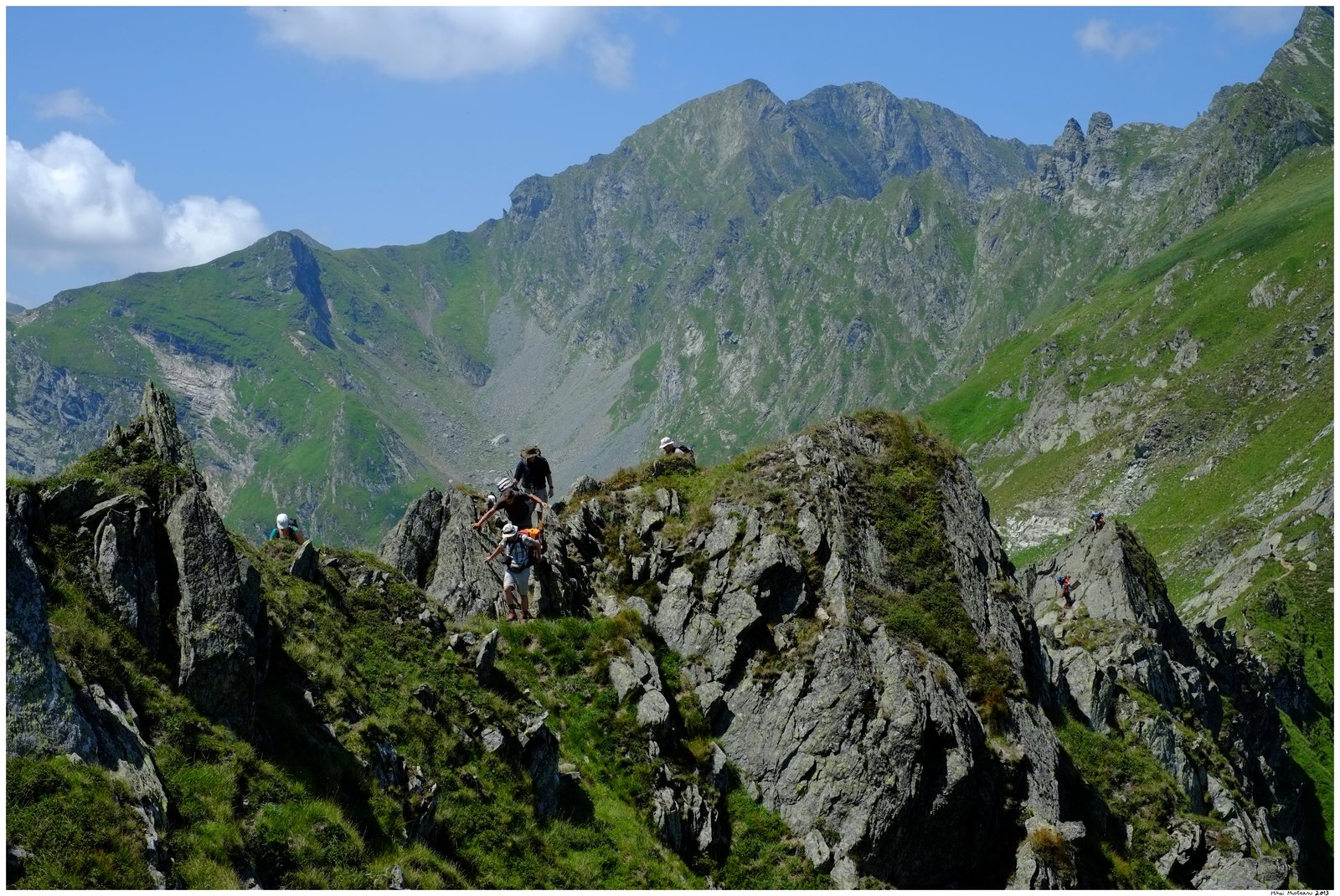
Fagarasi Mountains - The Transylvanian Alps

Less is more!
As this is a blog about running, I would usually mean that less of something means more running... However, this time less running means more photos. This Sunday I did a day hike on the main Ridge of Fagarasi Mountains. Vlad, my work colleague picked me up with his car at 5AM in the morning and we drove for more than 2 hours up to Balea Lake, at 2000m altitude, in the heart of Fagarasi Mountains, below the main ridge. We did a day hike along the main ridge, covering about 10% of the ridge length, between Paltinu and Mircii peaks.

In Fagarasi I get the feeling that the mountain overwhelms me, more than on other massifs in the Carpathians. Fagarasi are indeed the most massive and the highest mountains of the Romanian Carpathians. They really deserve the "Transylvanian Alps" nickname!

I took many photos on the way. I would not tell you the precise location of each photo... you have to go there and discover yourself... ;-)
Here is a selection of the photos. The complete album is also available on Picassa.


02 June 2013

Tusnad Marathon 2013

This Saturday, on 1st of June 2013, I ran the Tusnad Marathon race. A 23km road race in the mountains, just a bit longer than a regular half marathon. This year the event celebrated its 5th edition and one could tell this; it was very well organised!

I was not planning to participate in this race as I tend to avoid running on paved roads and I also avoid races during the heat of the summer. However, less than a week before the race, Andrei, a work colleague, an enthusiastic runner, reminded me of the race. I quickly checked the route on the race website. It looked good to me. More than half of it in the forest, on a winding road up a mountain! The the first 4km are on a main road but the traffic is restricted during the race. I then checked the weather forecast and the weather for the whole week was going to be cool. Indeed, the weather on the race day was cool, just perfect for running. 
After checking the route and the weather forecast and I decided that I have to participate and I have immediately register.

The race starts in the center of Baile Tusnad (Tusnádfürdő in Hungarian), a small spa town and follows the windy road  round and up the Ciomatu volcano which is towering above the city. The finish line is on the shore of the beautiful Sfanta Ana Lake. This lake lies in the middle of the volcano crater! No worries, it is an extinct volcano! The main signs of the past volcanic activity are the famous and tasty mineral waters of the region and a few rock cracks and caves where bad smelling sulfurous gas reaches the  surface.
Just after the start, in the center of Baile Tusnad (Photo from the race organizers http://www.tusnadmarathon.ro/)
The start of the race, in Baile Tusnad is at about 650m altitude. The highest point of the route, on the crater rim reaches about 1100m, and the finish line by the lake is located at about 950m altitude. So the route is mainly uphill, something that I like in a competition as I am better at uphills than downhills or flat terrain.

The race was very well and efficiently organised. I got my start kit in the morning before the race. It contained a nice t-shirt, the number and the timing chip. I leaved my luggage in the registration office and it was transported by the organizers to the finish line. When I arrived at the finish, my back-pack was waiting for me, carefully placed in a shaded luggage area. There were well stocked hydration points every 5 kilometers along the route with both water and isotonic drinks. They also had fruit bits and other energy snacks, but I did not pay attention to them as I had my large cereals portion in the morning.

There were about 150 participants at the starting line. Most of them in the individual race. There were also a few teams registered in the relay race. First part of the race follows the main road to the South until Bixad village. It then turns to the East and starts with an ascent through the village. From here to the end, the route follows a local road with very little traffic. After the village the road goes for a few kilometers across pastures. As the sun was shining, this was the hardest part of the race. It felt a bit too warm, but soon the road reached the forest. The rest of the route is mainly under the thick canopy of the forest. It rained the day before, so it was wonderful to run through the cool and fresh forest! Here, on the uphills in the forest I overtook several runners. I was overtaken by just one runner and I had to admit that he was a much better runner than me.

The ascent through Bixad village (Photo from the race organizers http://www.tusnadmarathon.ro/)
 After reaching the rim of the crater, the road descents for the last 3km until the lake shore. I ran as fast as I could, as I wanted to keep my place in the race, knowing that downhills are not my specialty. I managed to keep my place, being overtaken at some point by two guys that were in the relay race so I did not care.
I reached the Finish line in just a bit under 1h49. I was very pleased with my performance as my target was to finish the race in under two hours.

The finish line, just by the Sf. Ana Lake
As I crossed the line, the speaker announced my name and my place... 4th in my age category (out of 22) and 12th overall. It happened again! It looks like the 4th place is reserved for me! This is my third half marathon race that I have finished on the fourth place at my age category. Anyway, with an average pace of 4:44 minutes per kilometer this is the fastest race I have ever run! I may never run a faster race as I run mostly on trails.

 The famous Sfanta Ana Lake, inside  volcanic crater of Ciomatu
The overall winners in the male category
The overall winners in the female category
The overall winners in the relay category
I relaxed and enjoyed the lake views until the awards ceremony. Then together with Andrei we hiked back the 8km path to Tusnad. We could have taken the special bus that brought the runners back to town, but I wanted to enjoy a bit more the scenery and explore the surroundings.


Back in town I visited one of the mineral water springs and tasted the water!  Wonderful water; tasty with minerals and fizzy as it also contains CO2. Tusnad mineral water, rich in minerals is just perfect to replace the salts lost by sweating during the race! Isotonic drink from  Mother Nature!

Table with the mineral content of the water
The house of  the mineral water spring in Baile Tusnad
Overall, I found this race to be harder than a trail running one. I guess it is just because I am not  used to run a complete race on paved roads. It is not the road surface, but the speed of running. This was a fast race, faster than what I am used when running on trails and on steeper terrain.
In any case, I enjoyed much the race and the beautiful landscapes along the route. Both Baile Tusnad and Sfanta Ana Lake are special and beautiful places with nice people. I am always happy to return here.
Will I do this race again? Maybe. If the weather next year is nice and cool like it was this year, I may register again for this race! But it will be much tougher as I will aim for a better place than 4th... ;-)