8 June 2013.
St. Medardus Day. There is a saying in my city of Brasov (and not only here) that if it rains on this day, it will rain every day for the next 40 days. There is some truth in this saying, as the month of June is often quite wet in this mountainous corner of Transylvania. In any case, last two weeks were very wet and quite cool in Brasov - it rained almost every day. But after the unusually dry and very warm month of May the rains were more than welcomed!
For this day, I planned to do a training run with
Andrei in Piatra Mare massif. We plan to run together as a team this July in Bucegi
Marathon 7500 Hobby race. Even the shorter Hobby race is a tough one. For safety, because it takes place in high and steep mountains, this race is run in teams of two runners.
Due to the very wet weather we almost canceled the tour. Normally, on rainy days I stay closer to home, but this time we decided to ignore the weather, stick to the plan and do a tour that we will remember. At the end, running in the rain was a very good way to prepare for the Maraton 7500 race as the wet trails were tougher and more interesting.
The good thing was that almost no wind was forecasted for the day - also no thunder storms. So there was no danger to go up the mountain. Piatra Mare is not a very high mountain, a good choice for a day like this. It is covered in thick woods, except the higher part which has a small treeless and more exposed plateau.
The route we chose followed the main ridge of the mountain from the south to the north. We started the climb by DN1 main road, going up on Tamina forest road. The starting point can be reached by train. Timisu de Sus train stop is not far. But we just took a taxi from Brasov. Andrei left his car lower on Timis valley at Dambul Morii (also by DN1 road). Our route ended there.
At the beginning the route follows the Tamina forest road for about 5km. It has a gentle slope suitable for running. After 3-4km, the road passes very close to the Tamina waterfall. It is a spectacular waterfall in a narrow limestone gorge. We did not visit it as we were already wet enough from the rain. On a hot summer day it would have been a different story...
The track presented below is recorded last year on an hiking tour, but the route is identical to the one described in this post, except the last two kilometers.
After a little more than 4km on the forest road, in a small forest clearing we reached Tamina Chalet. I have no idea who owns it. It probably belongs to the Forest Authority. There is an abundant water spring here. From here the route leaves the forest road and continues with a steep long climb. Today, on rain, it was quite muddy and slippery.
After a while the slope eases and it also becomes less muddy, continuing the ascent through the pine forest on Galbeaza mountain flank of Piatra Mare.
 |
| Wet forest, wet and misty camera lens... |
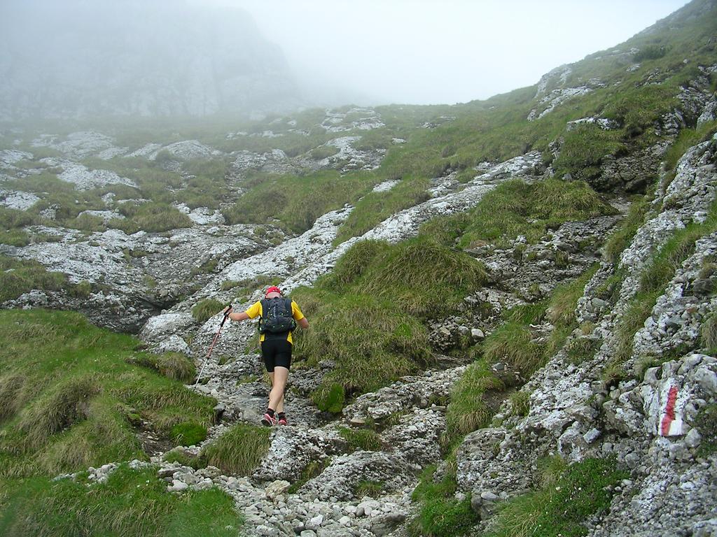
At about 1600m the trail comes out of the forest. From here to the top it follows the treeless high pastures. On a clear day it offers stunning views towards the surrounding mountains... Today we were happy that the fog is not thick and we can easily follow the path.
We pass by a shepherd hut. There are many cows around on the pastures and a few donkeys and horses by the hut. Luckily there are no dogs in sight. The weather must be too bad even for a dog...
Higher we reach the small top plateau and the slope eases even more so we can run again. Shortly we reach the summit at about 1800m altitude. The top is very close now.
A short run and we reach the summit.
No panoramas this time, yet the fog gives an mysterious atmosphere to the place.
I have time to take a quick self-portrait and then start running downhill. It is quite cold here as the peak is quite exposed. There is only a slight breeze but it feels cold as my t-shirt is soaked with rain water.
A bit lower from the peak we meet a beautiful patch of flowering rhododendron bushes. Time to stop for a couple of minutes and take a few photos.
We continue to run downhill towards
Piatra Mare Mountain Hut. As we feel quite warm we decide not to go inside for a cup of tea. I am afraid that if we stop it will be very hard to go out and start running again through the rain. By the hut I take a photo of a shepherd that overlooks a flock of sheep. A classical shepherd pose!
Again, no shepherd dogs in sight!
Lower on the mountain it becomes warmer and the rain seems to stop. We decide to take the longer route to Dambul Morii, by making a detour to Bunloc hill. The trail to Bunloc is not very popular and passes through some quite wild forest. It is not an easy route as it goes up and down several times. We run very slowly as the trail is slippery, soaked in water and it often gets quite rocky and technical.
After we just pass the the entrance to "Pestera de Gheata" (The Ice Cave) we find right on the path a baby deer. It looks week. It has no wound signs but it may be sick. I have to admit that I do not know much about deer - I cannot even tell how old it is. We make a few phone calls to ask for advice. We follow the advice and the common sense. We do not touch it and we leave it there. Better not to interfere with nature. Hopefully its mother is close.
As the trail descends towards Bunloc we come in and out fog. The forest looks amazing, with fresh green in the foreground and ghostly three silhouettes further in the fog.


I stop many times and take photos of the forest. At some point my old camera succumbs to the rain. It is not an waterproof camera. It is my oldest camera, an 9 years old Nikon Coopix. It only has 3 mega-pixels but I still think that it takes much better photos than most mobile phone cameras. It is small and I ran all the way with it in my hand. Slowly, as the water makes its way inside the camera the buttons stop working one by one. Luckily the shutter button is the last one that stops working. The photo below is the last one I could take... The foggy lens gives a nice atmosphere to the photo. Once the camera stopped working, I took the batteries out and put it in my back-pack inside a dry plastic bag where I keep my dry exchange t-shirt. I dried the camera at home and it works fine again! Of course, I would have not done this treatment to a newer more valuable camera...

Finally we reach Bunloc hill and get out of the forest. On the pastures it suddenly becomes warmer. It is not raining anymore and although covered by clouds, we can feel the sun's warmth .. We are at lower altitudes now - below 1100m and have left the cold and misty mountain peaks and thick woods behind. The last few kiometers to Dambul Mori are an easy run on moderate downhill slope.
This was a slow paced run that I enjoyed very much. We could have run faster, but there was no rush. The trails were slippery and muddy at times; I preferred to run slower, avoiding to fall or twist an ankle.
It is not too often that I go far from home and deep into the woods and mountains on such a rainy day. The views and landscapes were amazing. Once again, I am convinced that running is the best and the most enjoyable locomotion option on such terrain and on "bad" weather.