31 December 2022

2022 Statistics

 2022 in a nutshell:

  • About the same distance of running and walking/hiking as in 2021, but with more elevation gain.
  • Same number of cycling rides but much greater distance due to my Trans-European Ride of the summer.
  • Over 10 years of trail running,
  • 7 years of being vegan!


27 December 2022

Piatra Mare Cabin

The Piatra Mare cabin is located in the central area of ​​the Piatra Mare Massif, Brașov Mountains, at ​​an altitude of 1635 m. According to this source, the cabin was destroyed three times by fire and rebuilt again after each fire:

  • The first construction was erected by S.K.V. (Siebenburgischer Karpaten Verein – Carpathian Club of Transylvania) in 1884, being officially inaugurated in July 1885. It was destroyed by a fire in 1908.
  • The second cottage was built in 1910 by E.K.E. (Erdelyreszi Karpat Egyesulet – Carpathian Club of Transylvania). This too shared the same sad fate by disappearing in a fire in 1916.
  • The cabin was rebuilt four years later by the Brașov Tourist Association (B.T.E. – Brasoi Turista Egyesulet). In 1991 the cottage burned down in a relentless fire.
  • The new Piatra Mare cabin was built in 2003, by E.K.E. Săcele. The new building is located approximately on the site of the former annex. 
The old Mountain Chalet, probably in the late 1930s.
Oil Painting by Ștefan Barabas (Romanian painter, 1914-2007)


1965, postcard from Dan Mateescu collection (https://orasulmemorabil.com/cabana-piatra-mare/)


    The Ruin of the Mountain Chalet. Summer 2021

    The New Cabin on Piatra Mare and the old ruin. November 2018

    The Ruin of the old Mountain Chalet. November 2018

    20 November 2022

    Autumn Around Brasov

    Late October to start of Novemver is always the time of the year with vibrant autumn colors in the forests around Brasov. Here are a few photos from 2022's autumn.

    Near Brasov, at Pietrele lui Solomon

    Pietrele lui Solomon Gorge (Solomon Rocks), at the edge of Brasov City

    Beech tree forest near Brasov

    Beech tree forest near Brasov

    View towards west from Piatra Craiului Massif

    View towards west from Piatra Craiului Massif
     
    Piatra Craiului Mountains
     
    Magura Village, Piatra Craiului Natioanal Park

    Pestera Village, Piatra Craiului Natioanal Park

    Pestera Village, Piatra Craiului Natioanal Park

    Pestera Village, Piatra Craiului Natioanal Park

    View towards Bucegi Massiv from Pestera Village

    Bucegi mountains.Varful Scara (Scara Peak) 2422m. In the background Bucsoiul peak (2492m)


    Fagarasi Mountains seen from an airliner


    19 June 2022

    Transcontinental ride tour: Summary

     Two days after finishing my solo ride across Europe here is a summary covering various aspects:

    The 16 stages of the route

    • Duration
      • 17 days (1st to 17th of June 2022)
      • 16 days in the saddle, one break day (9th of June in Davos)
      • 119 hours of effective pedaling.
        • On average 7.5 hours of pedaling a day.
    • Length
      • Total 2600 km. From Cambridge UK to Savârsin, Arad County in Romania.. 
      • A bit over 22 degrees in longitude and about 6 degrees in latitude.
      • Longest day stage: June 16, 2022. 263 km, 10h17`. From Mohacs (Hungary) to Arad (Romania). This was also the flattest stage.
      • Average day stage length: 162km (100 miles)
      • 9 Countries: UK, Holland, Belgium, France, Switzerland, Italy, Austria, Hungary, Romania
    • Average speed: 22 km/h
      • It does not sound too much, but it includes all climbs and traversing towns and cities. The route also had long gravel sections and many roads with poor surface
    • Elevation gain
      • Total accumulated elevation gain: 19750 m
      • Highest elevation gain in one day: 2675 m, passing two alpine passes
      • Average daily elevation gain: 1250m
      • Crossed 7 passes in 4 mountain ranges: Ardennes, Vosges, Jura, Alps
        • Ballon d' Alsace (1177 m). Vosges
        • Scheltenpass (1051 m). Jura
        • Alpine passes: 
          • Fluela Pass (2383 m) - Highest point of the route
          • Ofen Pass (2149 m)
          • Jaufenpass (2094 m)
          • Sella di Dobbiaco (1219 m) - Not quite a pass.
          • Klippitztörl Pass (1642 m)
          • Hebalm (1410 m)
    • Bicycle
      • Decathlon B'Twin Ultra. 
        • Mid Range Road bike from 2019
        • Full Shimano Ultegra equipped (2x11 speed, rim brakes)
        • Aluminium frame, carbon fork.
        • Aluminium wheels
        • All stock except the softer saddle (Selle Italia Shiver Gel Flow) and narrower handlebar (38 cm)
      • Bicycle weight including all luggage and full bottles of water: 17kg of which about half is the bicycle and half the luggage .
      • This proved to be a very robust bicycle. Except chain lubrication/cleaning and a few pumps in the tires no other maintenance was needed
      • Tires: Vittoria Randonneur 700x28c
        • Cheap and very strong with puncture protection layers.
        • Had 0 punctures!
        • Not the fastest or lightest tire though.
      • Bicycle maintenance kit: mini pump, spare tube, tube patches, multitool, tire levers, toothbrush (for chain, sprocket cleaning) chain lube (only for wet conditions... not the best idea as it is quite sticky)


    • Safety
      • Every single top piece of my cycling clothing was in high visibility green color! Also the helmet.
      • Lights: A powerful LED headlight. Two miniature LED position lights. Only used the once when passing through two road semi-tunnels.
      • Had a bell and used it quite often when overtaking other cyclists.
      • Always used cycling glasses with UV protection, mostly colorless ones.
      • Had a first aid kit with me. Luckily, I have never touched its contents during the trip
      • Used sunscreen cream daily
    • GPS Cycling Computer
      • Garmin Edge 520 plus
      • Rather old and basic model, but after learning its quarks it is very capable.
      • Used stock firmware, no extra applications
      • Battery only lasts 8h so I also had a very small external battery,
    • Route Planning
      • I used Garmin Connect, using its "popularity" option that uses the heatmap from users' activities. In this way I discovered amazing cycling routes.
      • I used OpenStreetMap to see the official european cycling routes
      • I also used Google Street View to get an idea of how various roads along the route look.
        • This helped me to identify and avoid potentially dangerous roads for cycling
      • Route surfaces
        • 50km of gravel cycleways in the Italian and Austrian Alps.
        • The rest paved of different types from dedicated cycleways to roads
      • I tried to avoid large cities as they are hard and slow to navigate through, Also not the best place to leave your bike unattended.
    • Accommodation along the route
      • Never planned more than a day in advance
      • Preferred a certain level of comfort for a good rest:
        • All were single rooms with private bathrooms (I also rinsed my smelly cycling clothes every evening...)
        • Almost all had breakfast included
      • All sorts of types: Ferry cabin, AirBnB, 2,3,4 star hotels, bed and breakfast.
      • I found a secure place to store the bike overnight at every place I stayed: underground garage, storage room etc.
    • Food/ Mostly from supermarkets for several reasons:
      • Very fast to get food/drinks. Can be eaten on the spot or taken away as it is always packaged.
      • Consistent food standards - never had any stomach issues
      • I am vegan and many restaurants do not have good vegan options
      • Staple foods: Dense integral+seeds breads, baked beans, fruit smoothies/juices, bananas
      • Lots of fruit, muesli and nuts batons... got sick of them!

    • Food supplements:
      • A daily multivitamin + minerals pill
      • A salt pill every 50km or so. Every pill contains 15% of the daily Mg, Na and Ka..
      • I added extra salt (NaCl) to food on the days I sweated a lot.
    • Costs: 
      • On average about 100 Euro / day for accommodation and food
    • Sustainability...
      • Probably not as sustainable as it seems!
      • Buying food mainly from supermarkets means a lot of packaging waste, especially that in most places I could not figure out where are the bins for recycling.
      • In the mountain stages I always found water sources to refill my bottles. Otherwise I wasted a lot of plastic bottles...
      • I guess that the crossing the Channel by train would have been more environmentally friendly than taking the ferry.
      • Luckily the weather was not too hot so I did not have to use air conditioning in the places where I spent the nights.
      • In Romania, after the last stage I was collected by a friend by car. I could have taken the train, but the Arad-Brasov train line is practically closed as upgrading work is taking place. At least my friends car runs on cleaner GPL and he has a very economical driving style...


    17 June 2022

    Day 16. Final Stage

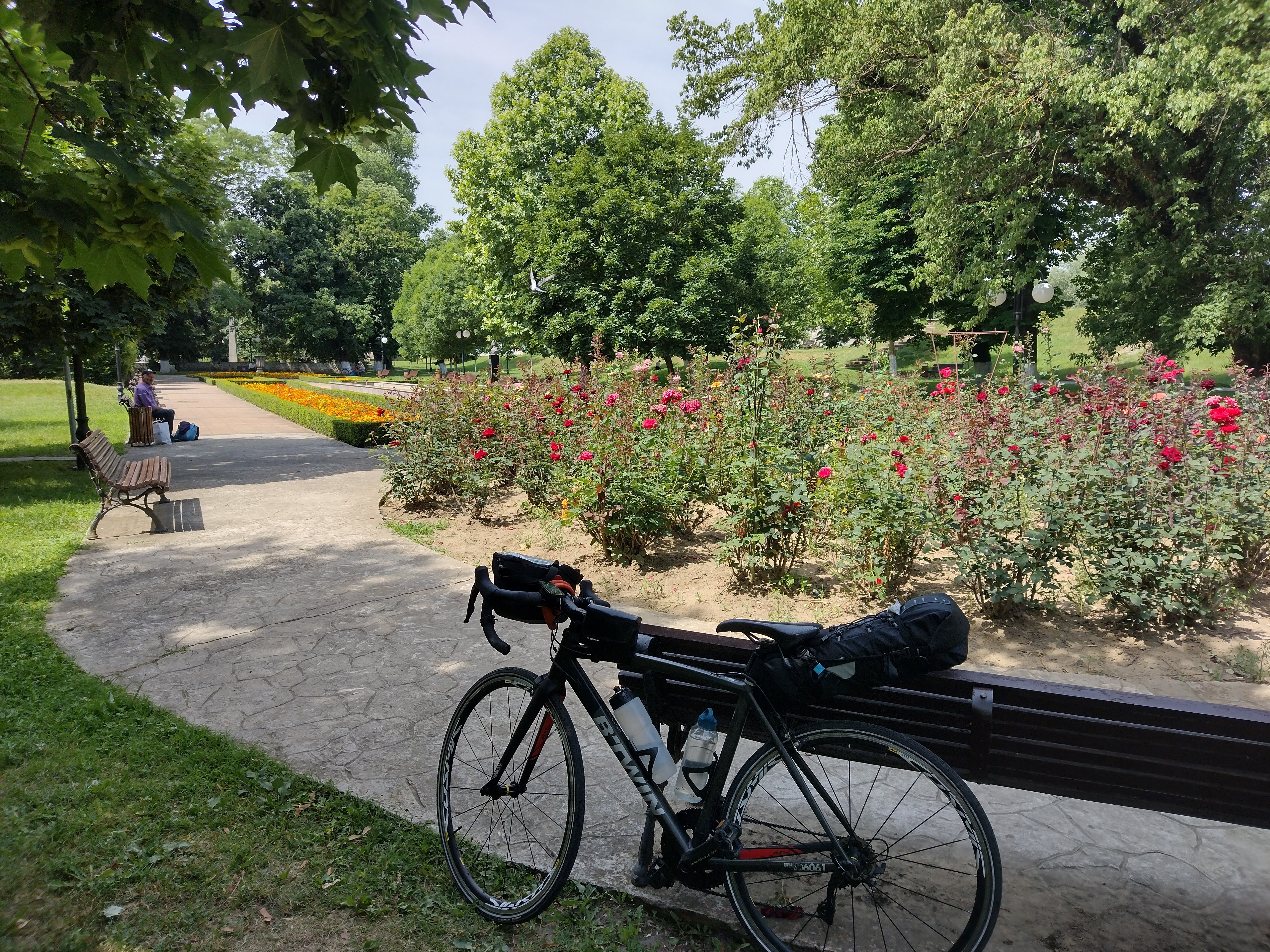
    Amazingly, I have reached the foothills of the Carpathian Mountains on the bicycle exactly as planned. The end of the tour was planned at Săvârșin, on the Mureș river valley, 330km from my home in Brașov as I could not find a safe and reasonable direct route over the mountains.
    Anyway, 2600 km with almost 20000 m of climbs in 16 days of  cycling is enough I would say!
    Cristi, a good friend came to collect me by car. Again, good planning... I arrived 10 seconds before him at the meeting place...

    The good thing is that I managed to reach the end of the route unscratched and without any kind of road incident. I also used every item that I had with me and did not miss anything! The bicycle performed amazingly well! Not a flat tire, not a loose screw! The only maintenance I did was to keep the chain reasonable clean and lubricated.

    A next post will give more details into planning and how the tour went.


    Check out my activity on Strava: https://strava.app.link/VaYYTDnnWqb


    16 June 2022

    Day 15. Traversing the frying pan

     Today's ride was my longest and flattest one that I have ever done. After crossing the Danube River by ferry I crossed the entire eastern Hungarian planes until I reached Tisa River at Szeged. Then I continued until Arad in Romania. Soon after crossing into Romania I could see in the distance the Carpathian foothills that border the planes on the eastern side.


    Check out my activity on Strava: https://strava.app.link/stbu4l5JUqb